Denver International Airport 50-Year Vision
A Framework for One of the Largest and Most Complex Aviation Districts in the United States
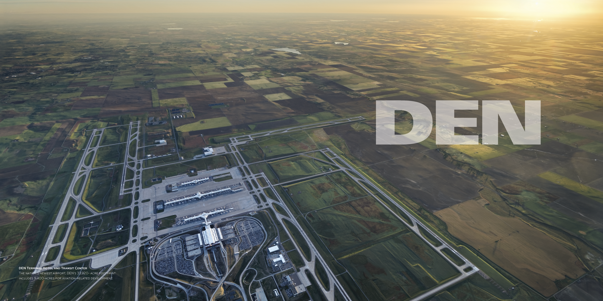
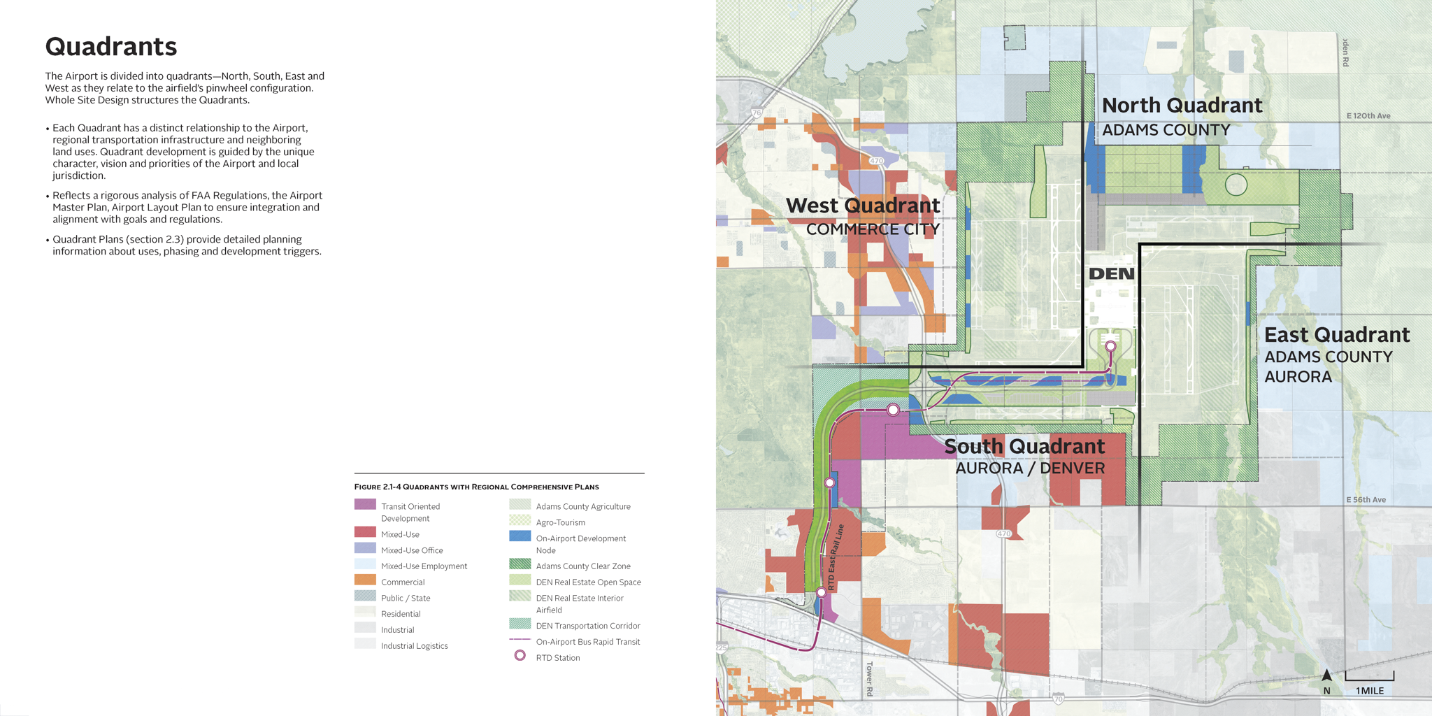
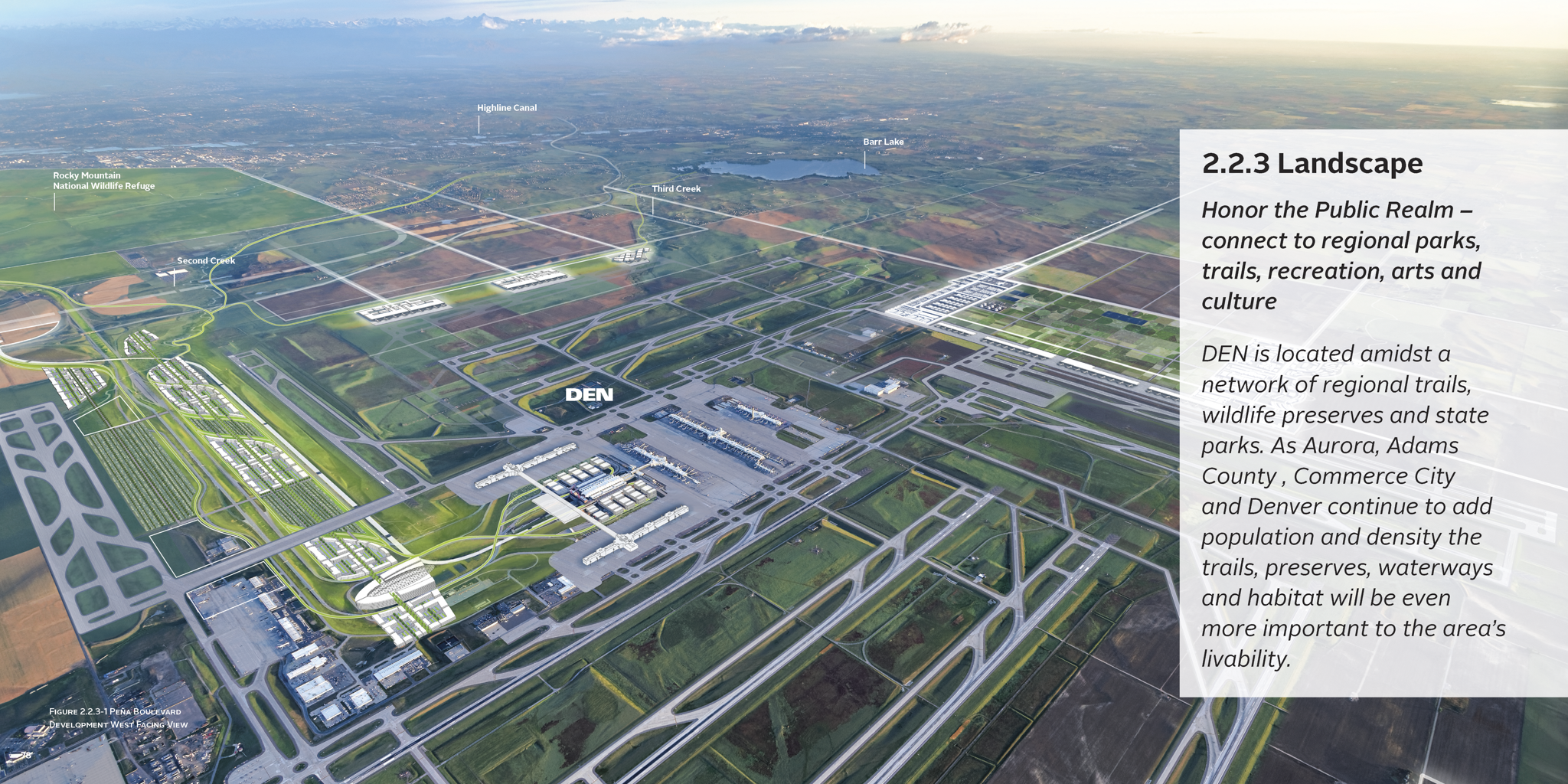
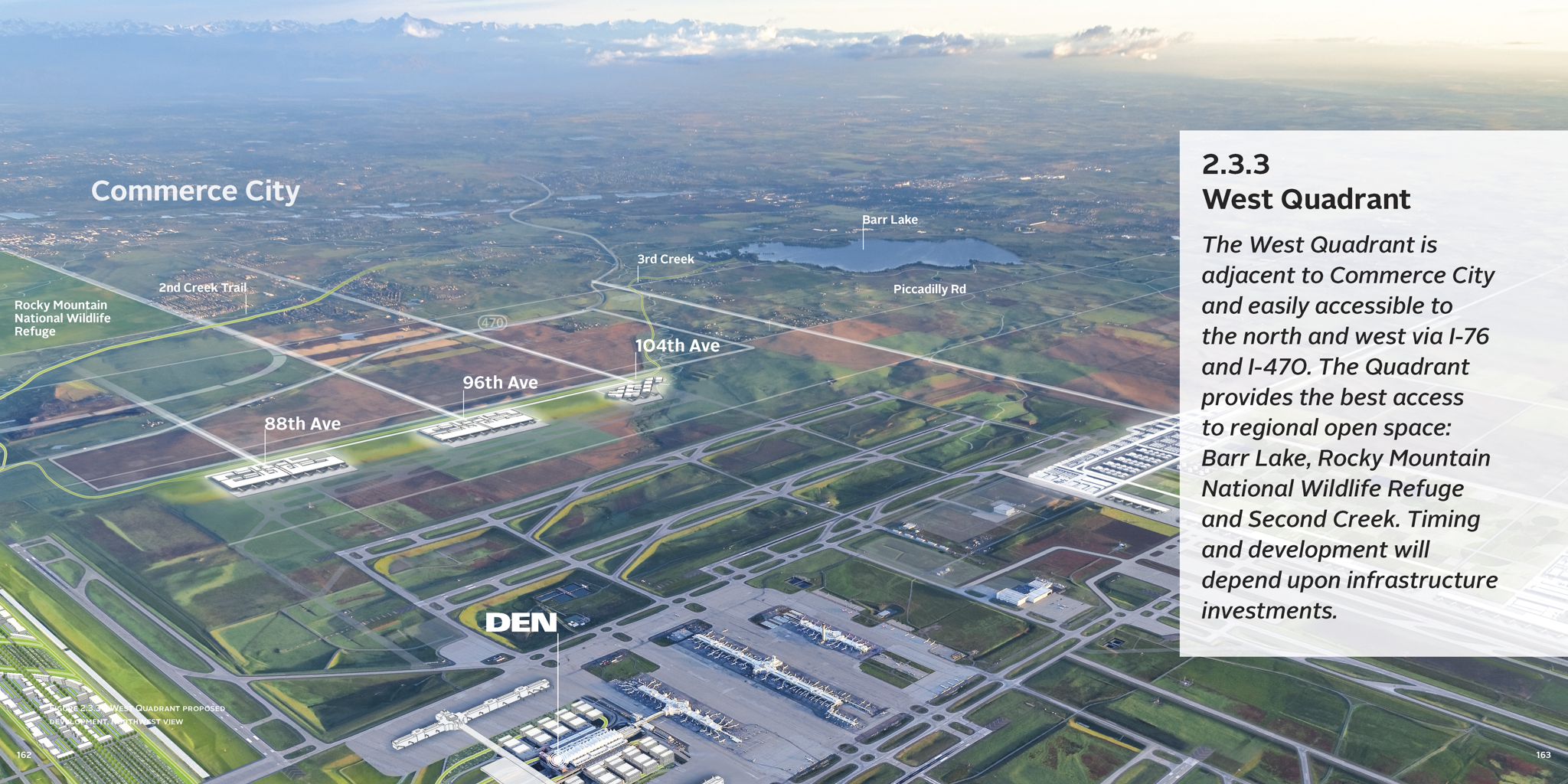
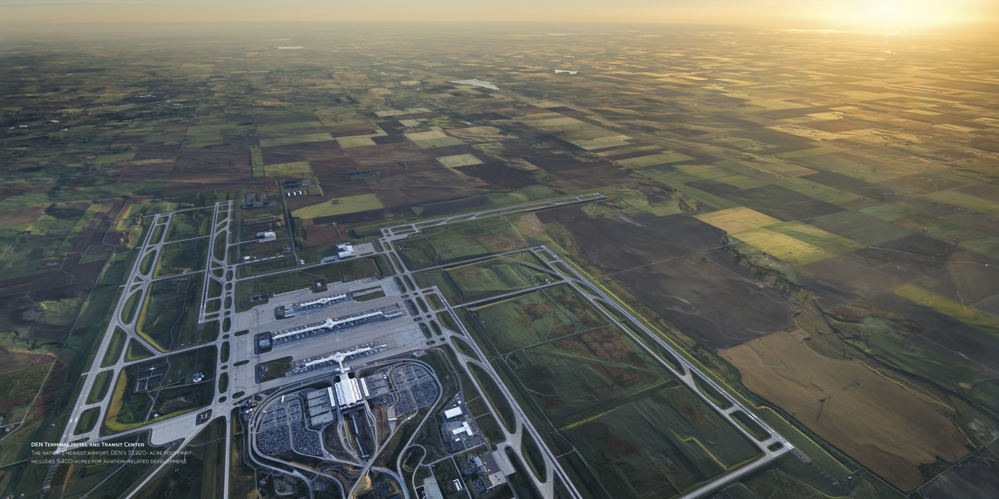
A 50-year long-range vision for Denver International Airport's 52-square-mile aviation district — integrating airside operations, multimodal mobility, mixed-use development, and natural systems into a coherent framework for phased, implementable growth.
-
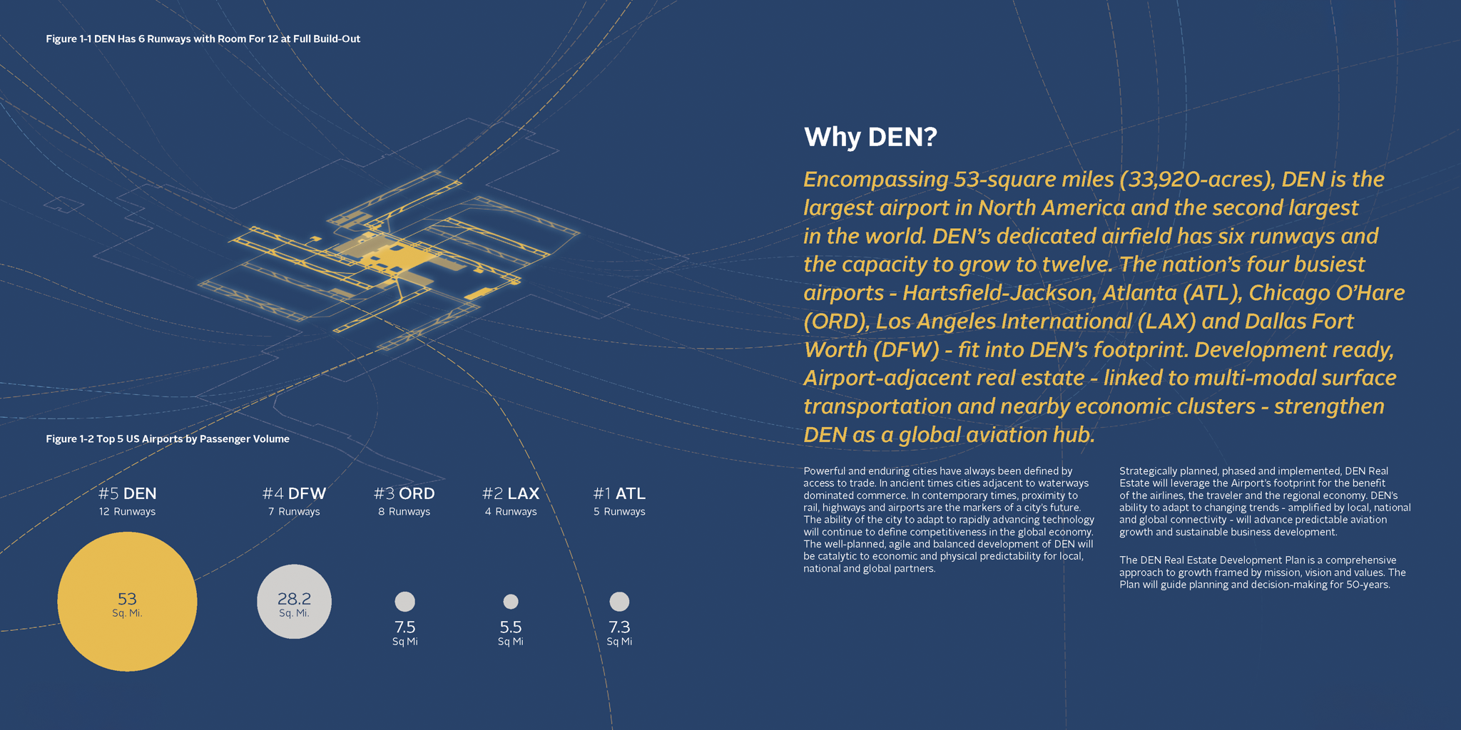
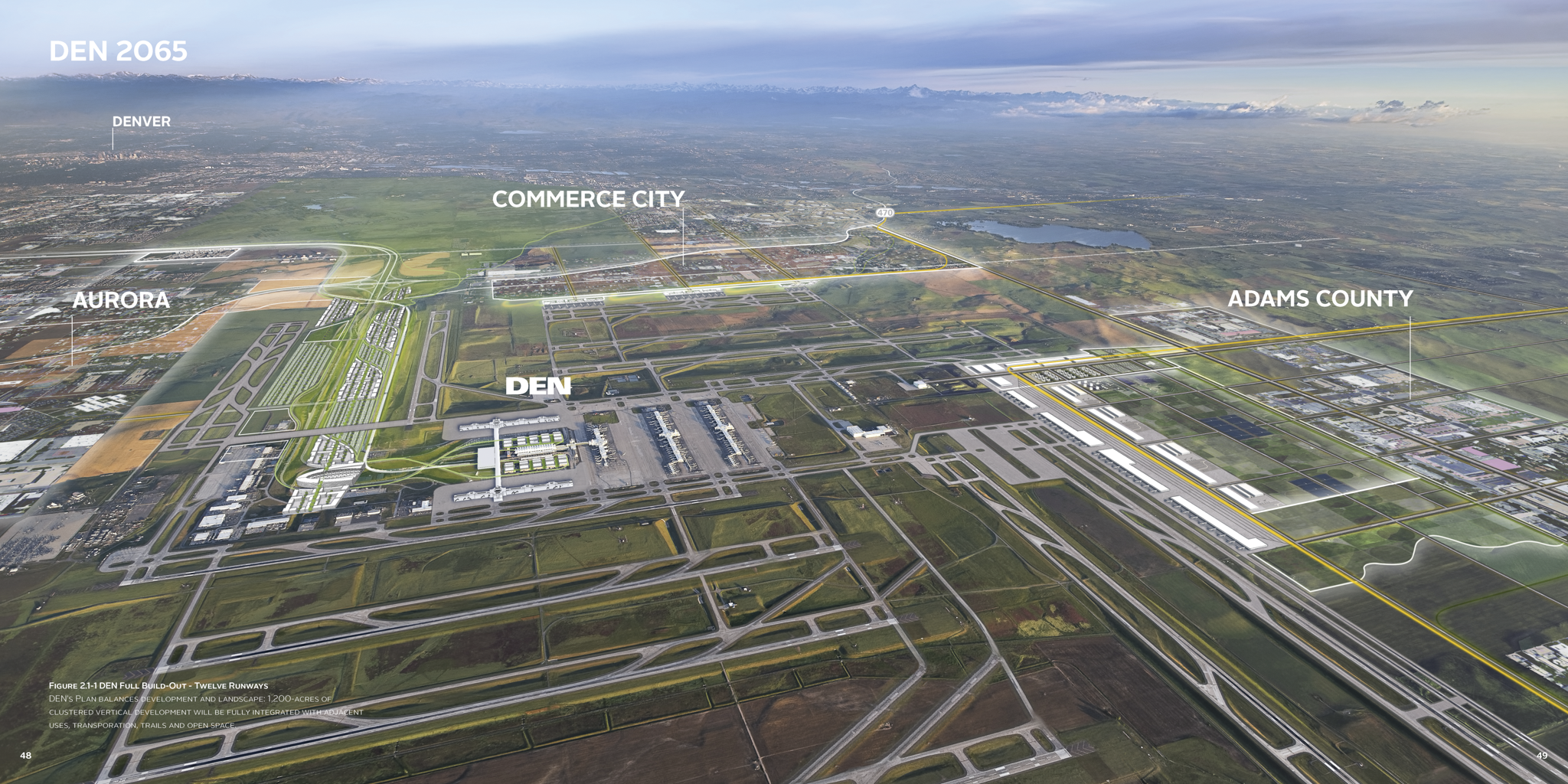
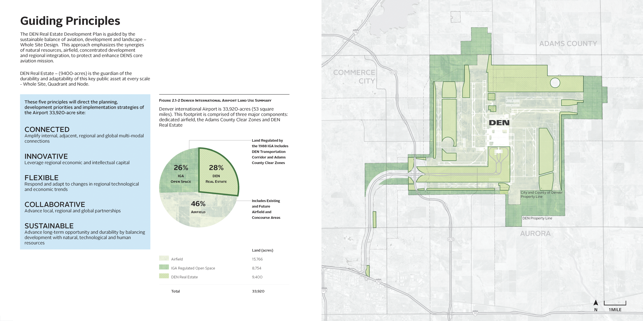
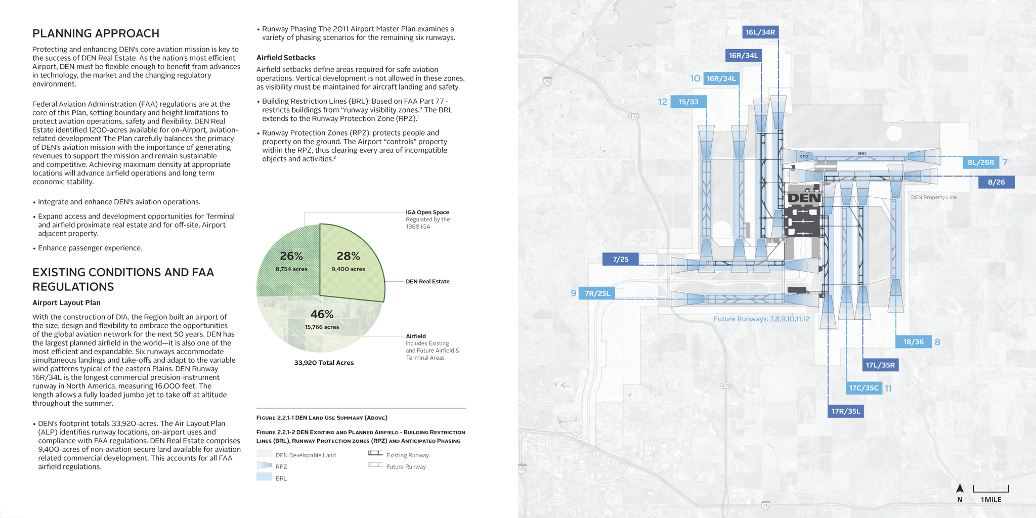
At 53 square miles — large enough to contain the four busiest airports in the US combined — DEN held extraordinary development potential with no spatial framework to guide it.
52-square-mile aviation district with uncoordinated land development potential
Existing multimodal infrastructure underutilized as a civic organizing system
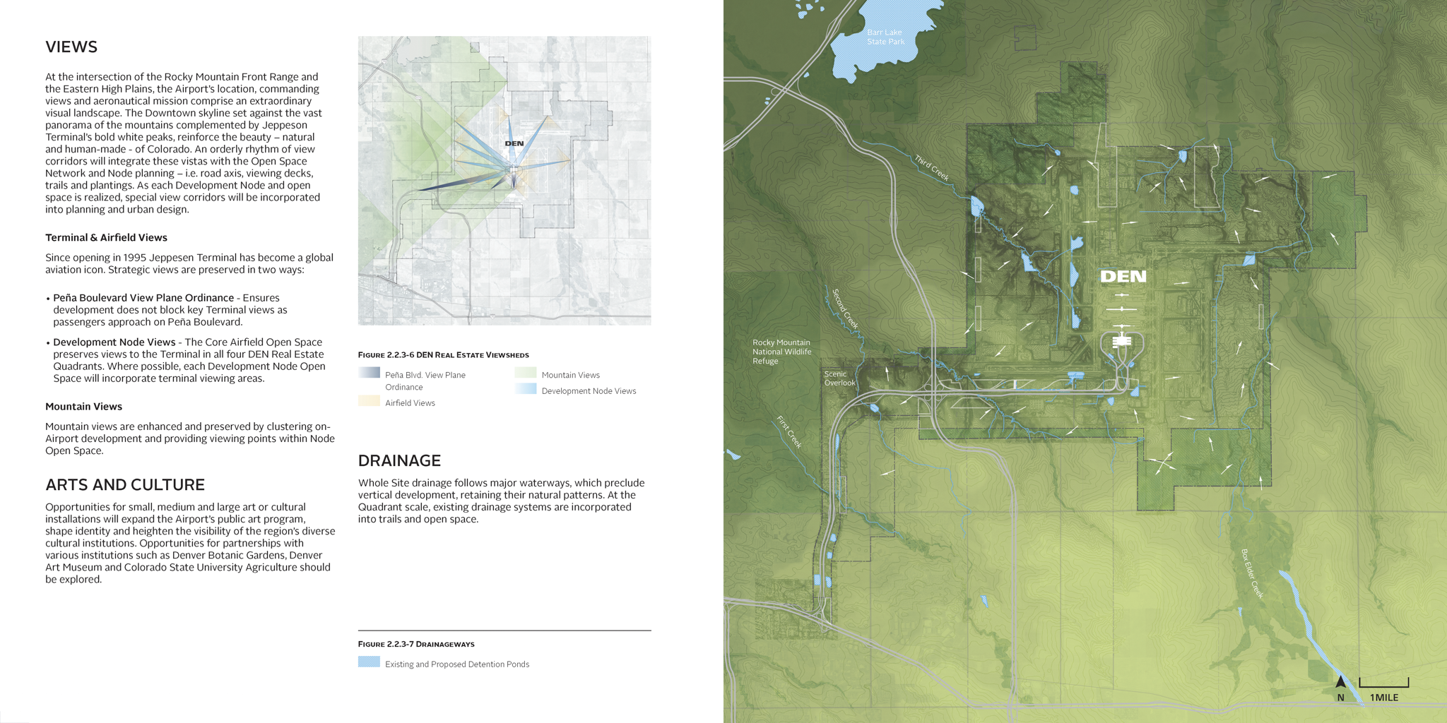
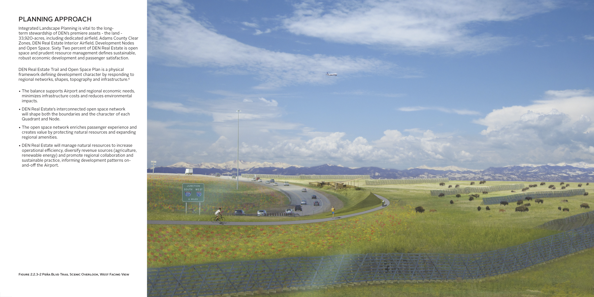
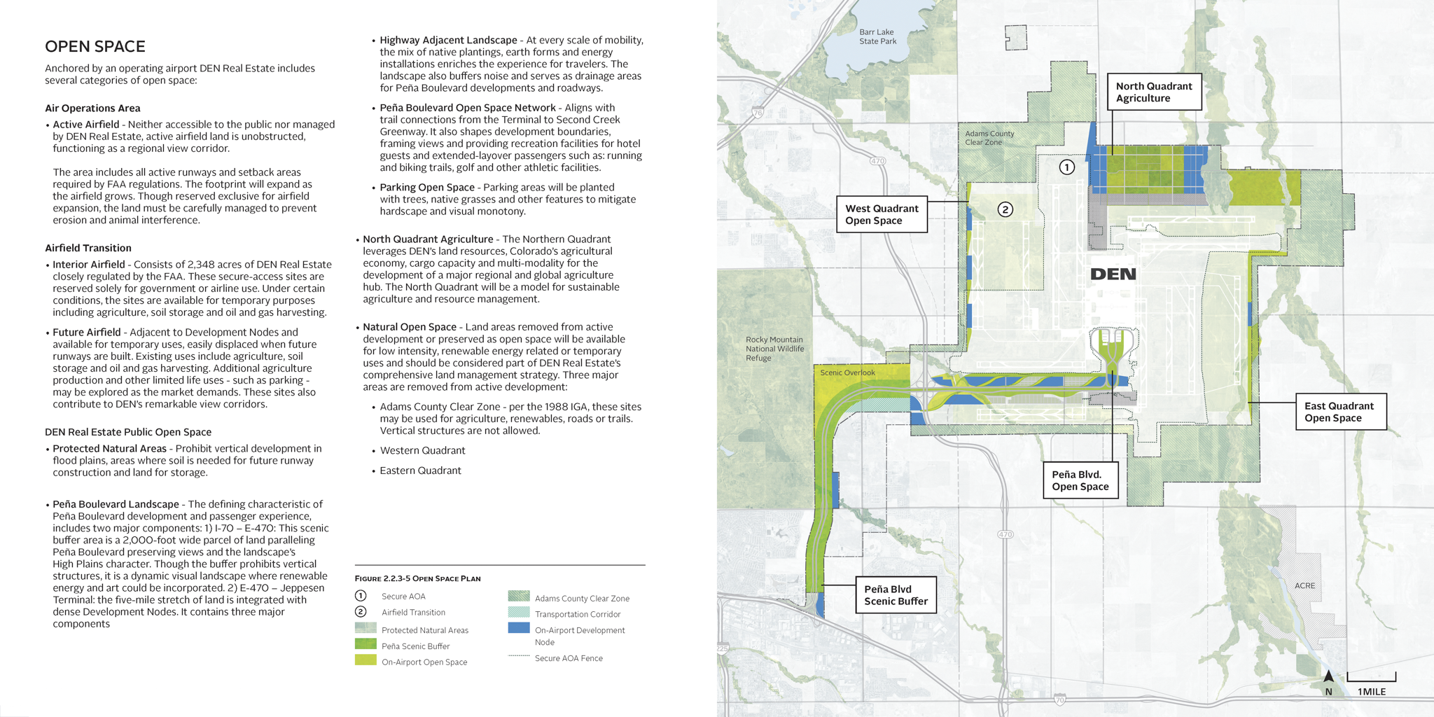
Natural systems and stormwater corridors largely absent from planning frameworks
Adjacent jurisdictions with unaligned infrastructure and regulatory agreements
No spatial hierarchy connecting airside operations to long-term land use
-
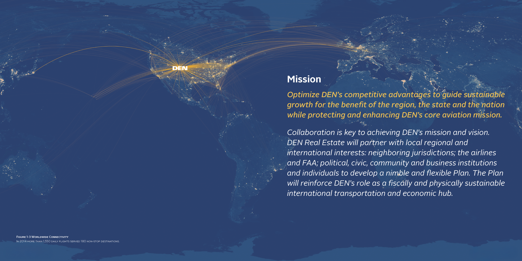
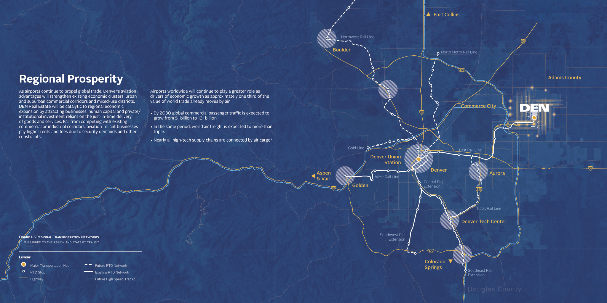
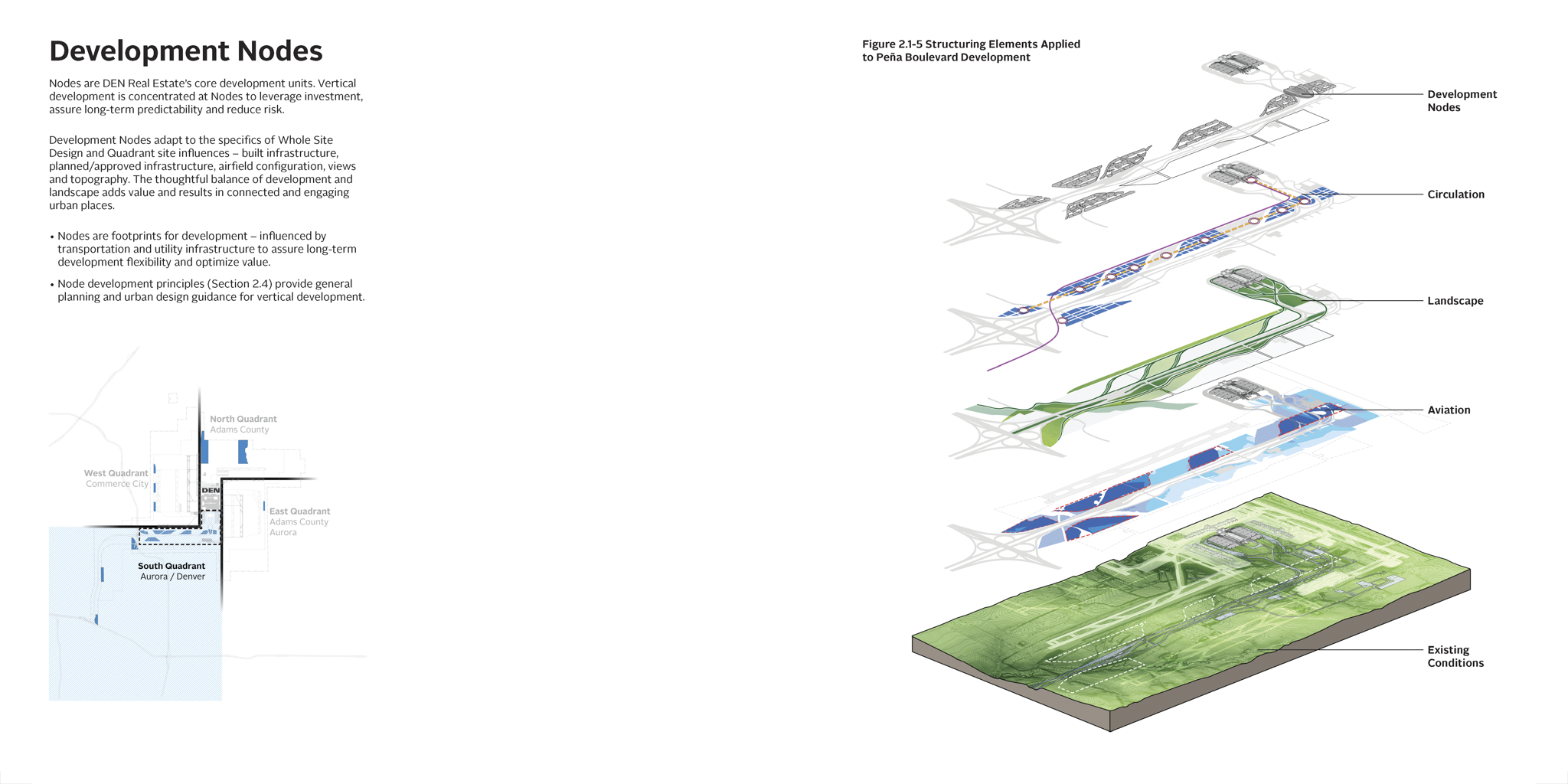
An infrastructure capacity analysis revealed that existing and planned roads, transit, and utility systems — including the RTD East Commuter Rail Line linking DEN directly to Downtown Denver — could support a more concentrated development footprint, aligning growth with available resources, preserving open land, and building realistically from what was already in place.
Align aviation infrastructure sequencing with land development potential
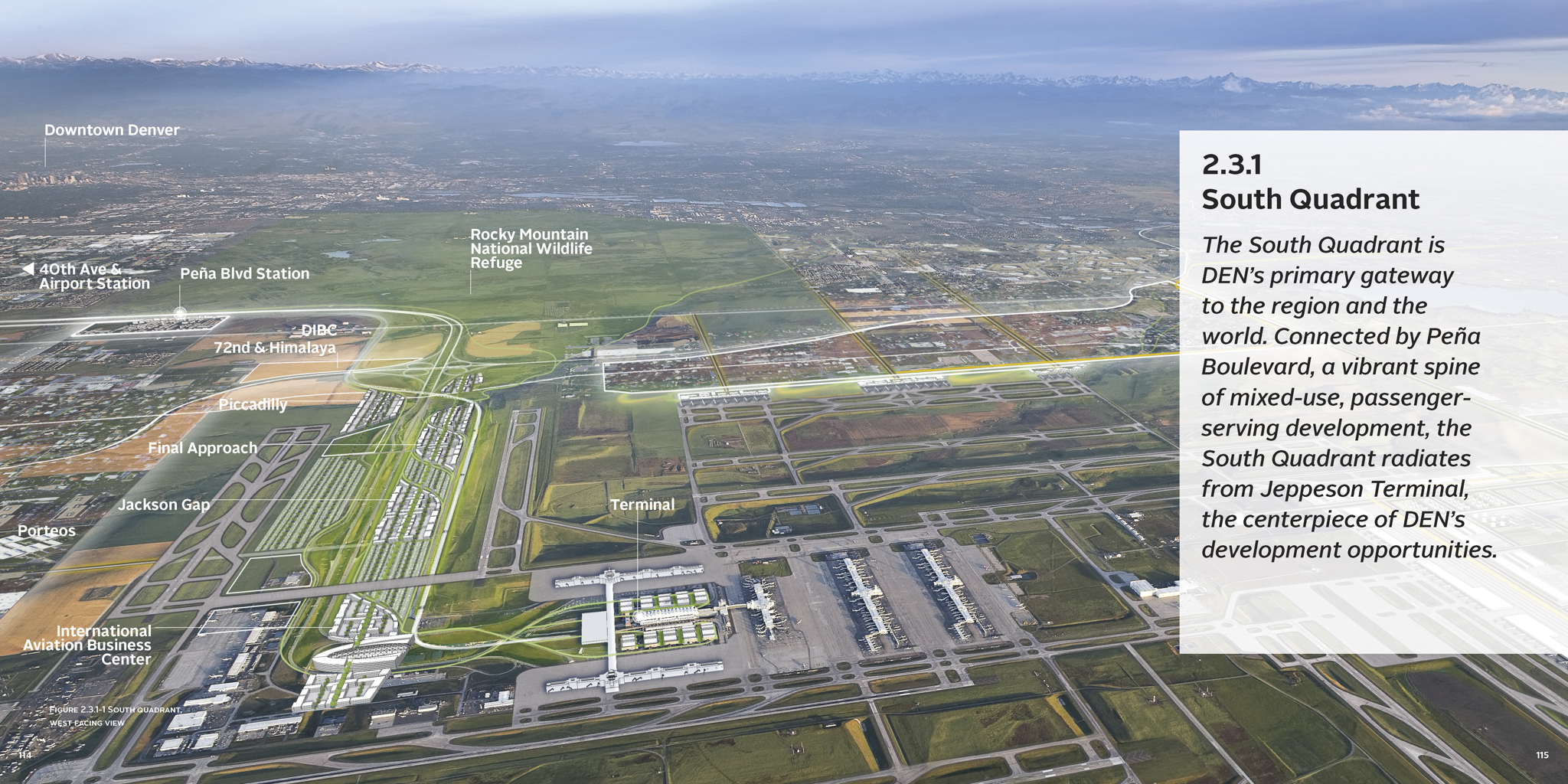
Establish strategic development nodes anchored by existing capacity
Build a multimodal circulation system supporting future transit expansion
Integrate resilient utility and stormwater systems into the land framework
Create the conditions for intergovernmental coordination across municipal boundaries
-
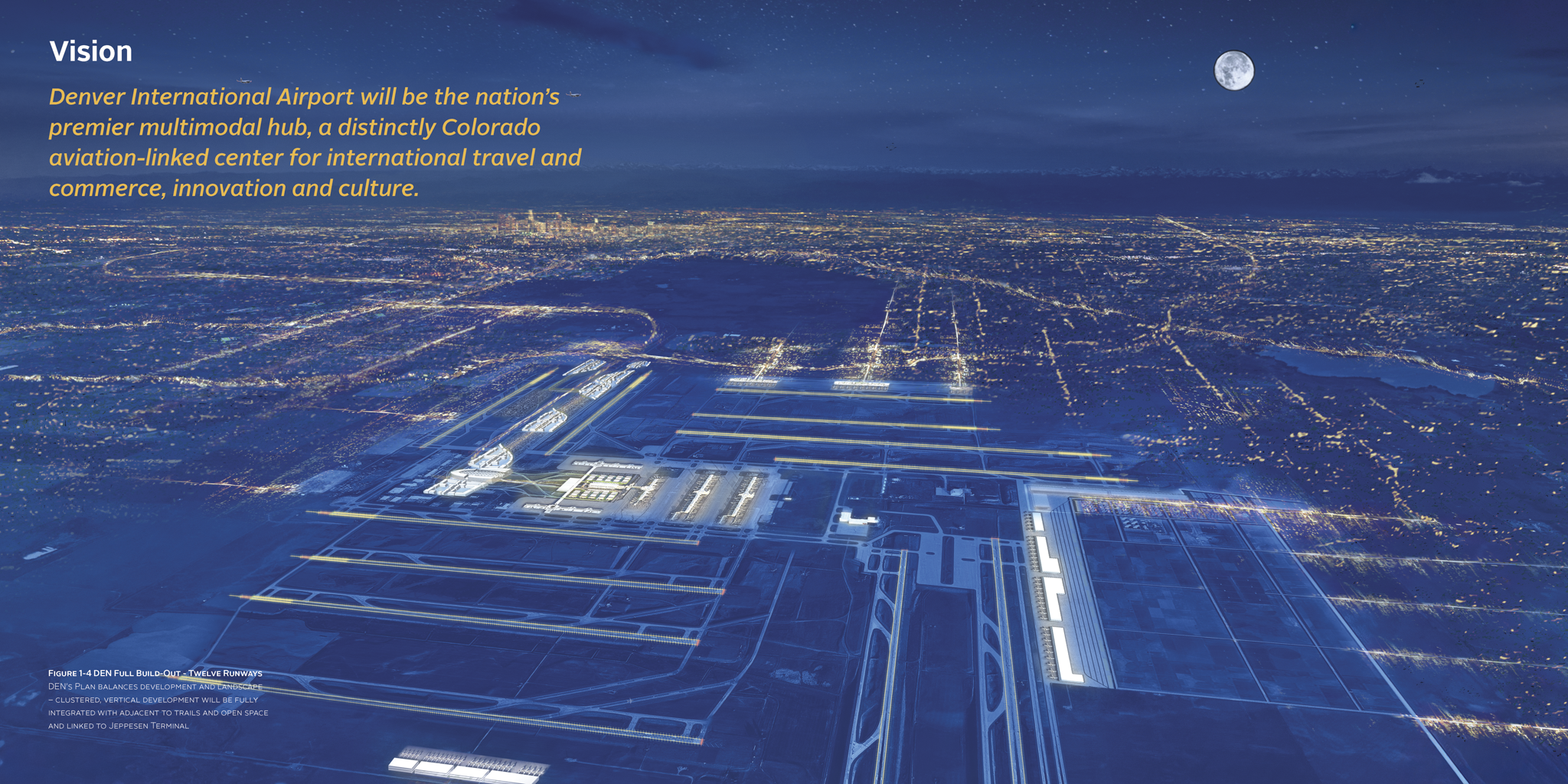
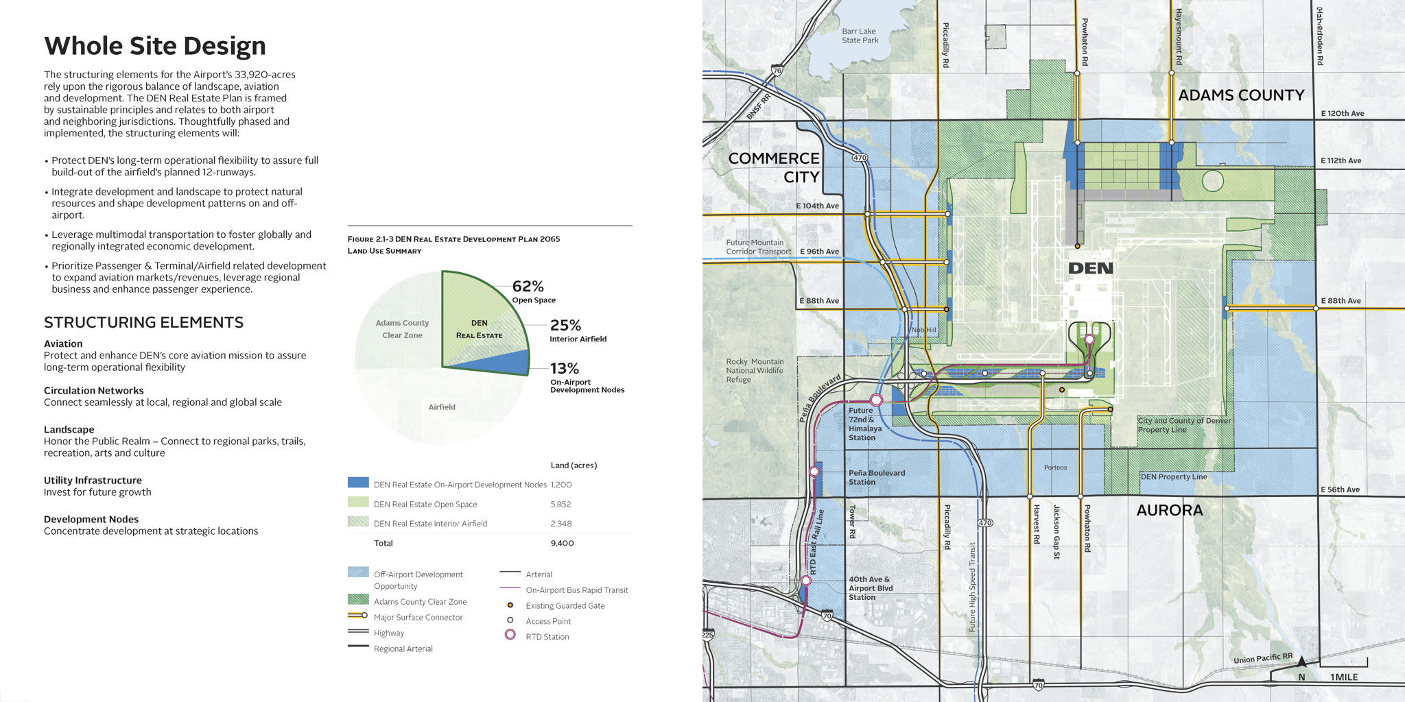
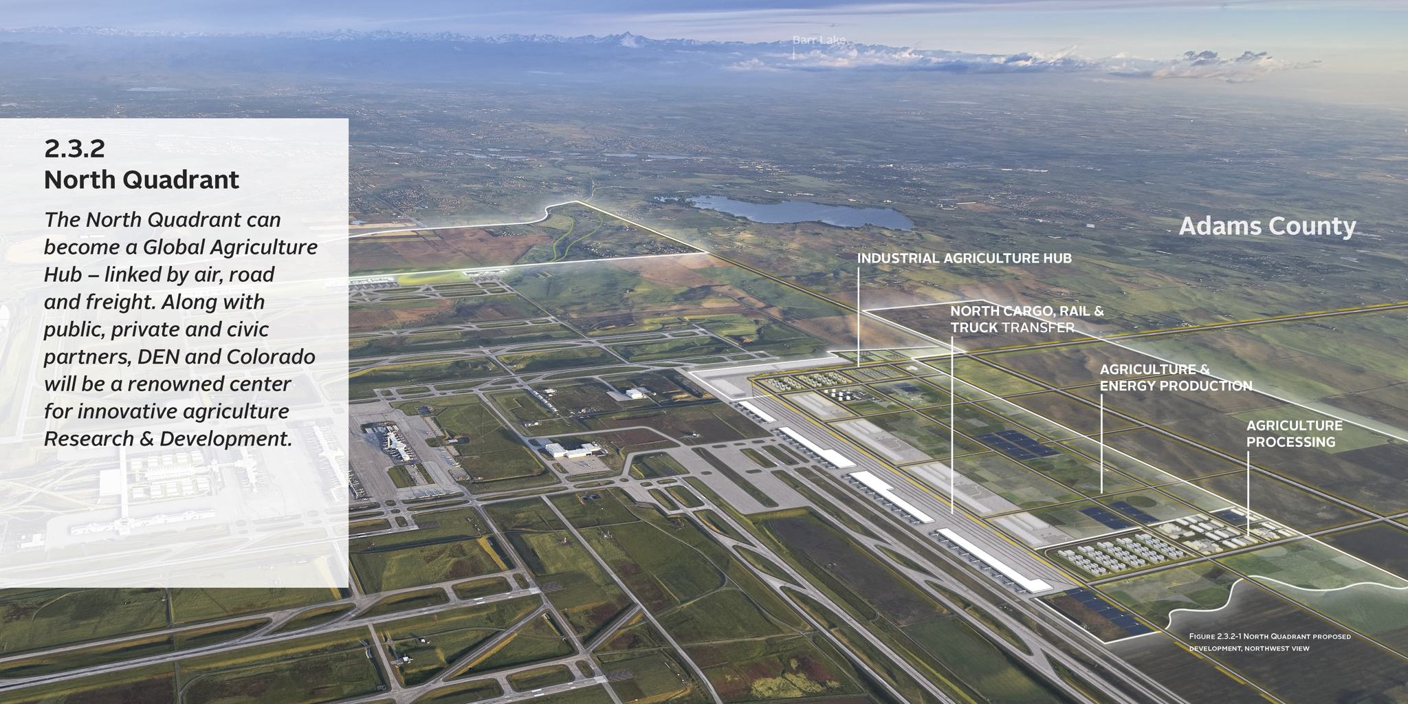
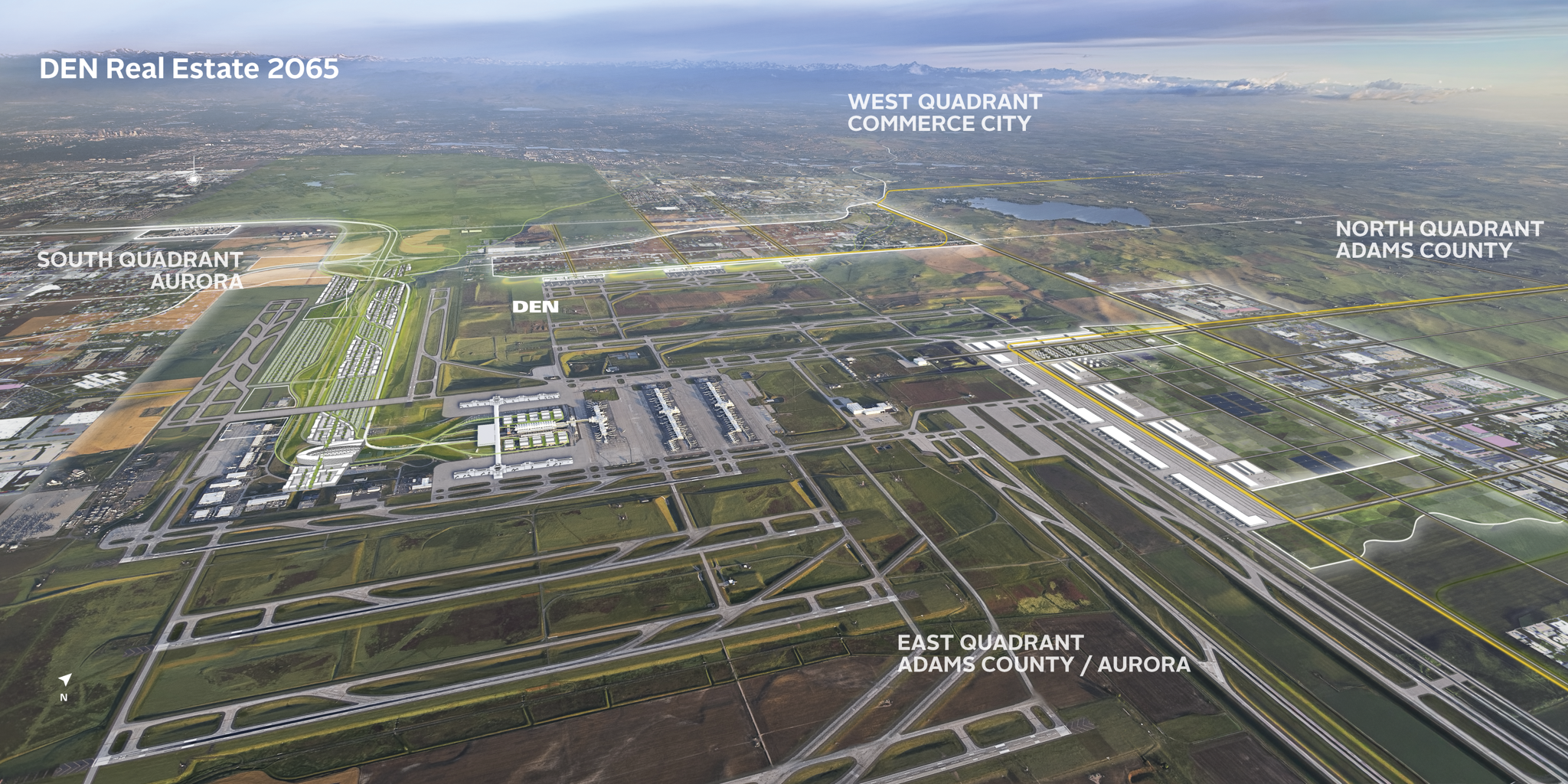
The largest airport in North America by footprint, DEN was positioned to become the nation's premier multimodal hub — a Colorado-rooted center for aviation, commerce, innovation, and culture. The 50-year framework established the agile, balanced development structure needed to make that vision implementable: organizing land use, mobility, natural systems, and infrastructure capacity across four quadrants and multiple development nodes, with phasing strategies tied to real market and aviation growth conditions.
Flexible land use and character framework organizing 52 square miles
Multimodal circulation system supporting phased transit expansion
Strategic development nodes prioritizing early-phase investment
Resilient utility and stormwater infrastructure integrated into land framework
Intergovernmental agreement strategy enabling coordinated regional growth
-
Client: Denver International Airport
Role: Urban Design and Master Planning Lead*while at Tryba
Aviation, Transportation and Civil Engineering: Jacobs
Market Study: Jacobs
Deliverables:
Long-Range Real Estate Development Plan
Four-Quadrant Development Framework
Multimodal Circulation Plan Landscape and Open Space Plan Utility Infrastructure Plan
Economic Development Strategy
Stakeholder Engagement