I-Fourteen District
Connecting Innovation, Recreation, and the Natural Landscape in Bentonville, Arkansas
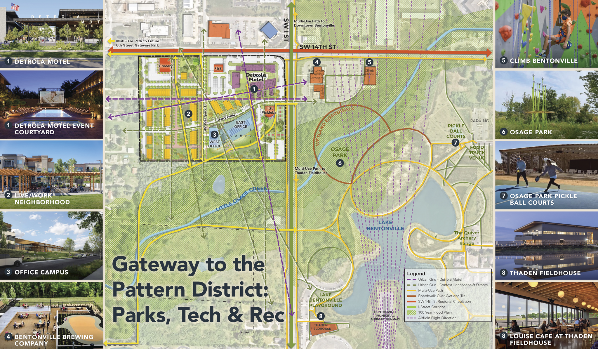
A master plan and architectural vision for a 26-acre mixed-use district at the gateway to Bentonville's Pattern District — anchored by a high-tech office campus and organized around Little Osage Creek, the Bentonville Municipal Airport, and the city's expanding network of parks, trails, and recreation.
-
The I-Fourteen site occupies a rare threshold in Bentonville — between the city's growing innovation economy and its world-class recreational landscape — but the two systems had no physical or experiential connection. Little Osage Creek ran through the site largely unacknowledged, and the airport's final approach created a powerful axial geometry that existing development ignored.
Little Osage Creek corridor as an underutilized ecological and recreational asset
Airport final approach as a defining spatial axis organizing views and arrival
SW 14th Street as a regional circulation spine connecting the district to the broader city
Existing Pattern District amenities — Thaden Fieldhouse, Osage Park, Lake Bentonville — immediately adjacent but disconnected
-
The creek, the airfield geometry, and the adjacency to Bentonville's recreational network defined a clear organizing logic — align the district along the natural and infrastructural axes, activate the creek as public open space, and build the pedestrian connections that would draw the Pattern District's energy into the site.
High-tech office campus as catalytic anchor for district-wide mixed-use development
Little Osage Creek activated as ecological spine and public trail corridor
Airport final approach axis as primary street and arrival sequence — Short Final
Live/work residential neighborhood integrating housing, retail, and landscape
Detrola Motel adaptive reuse as cultural and hospitality anchor
Multi-use path network connecting to Pattern District parks and regional trail system
-
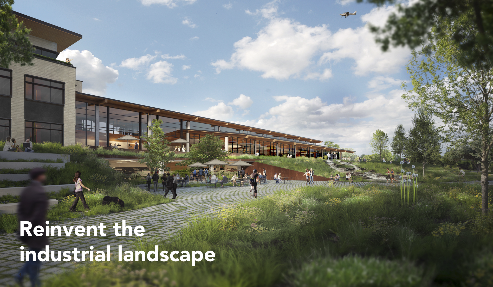
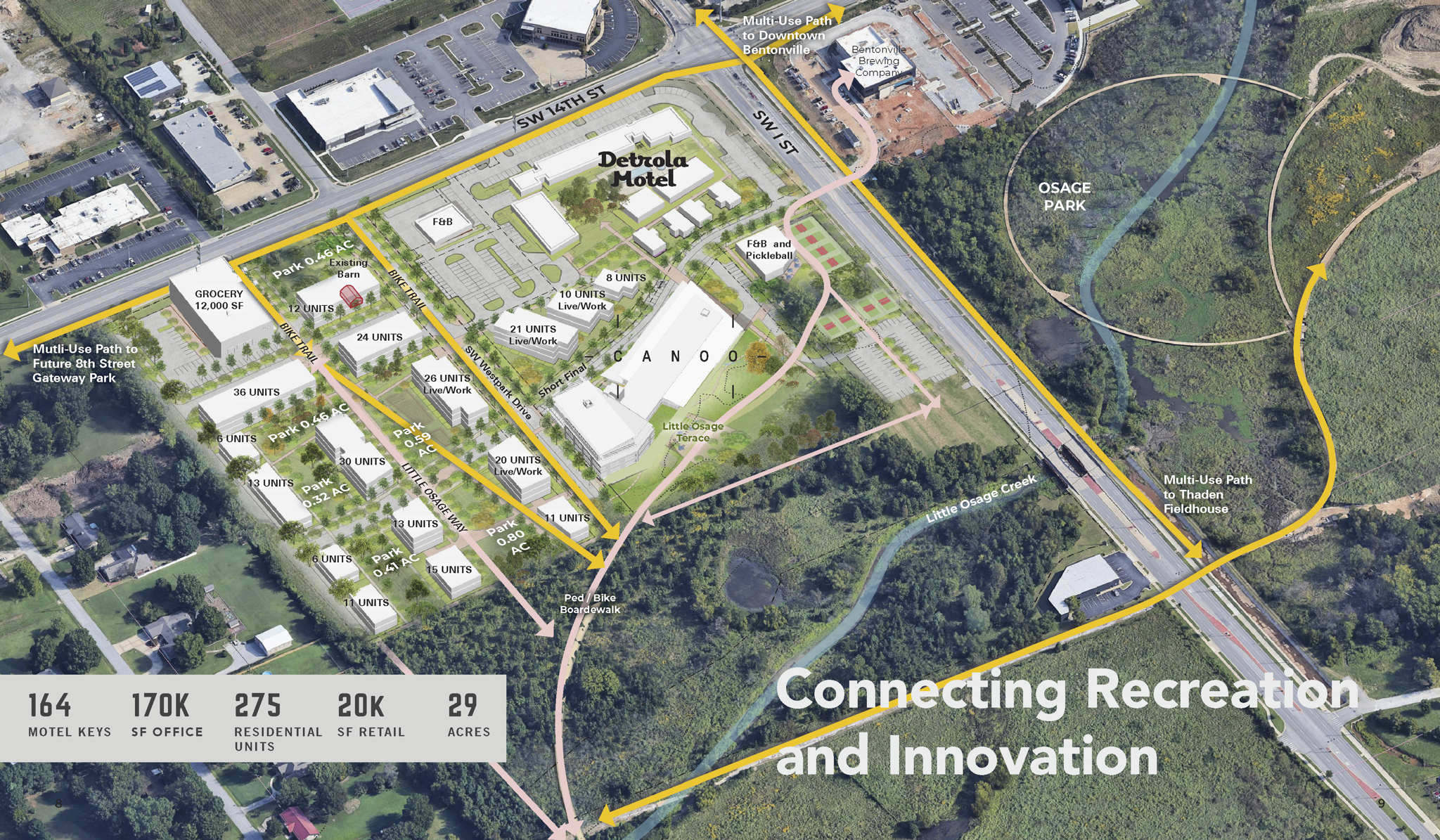
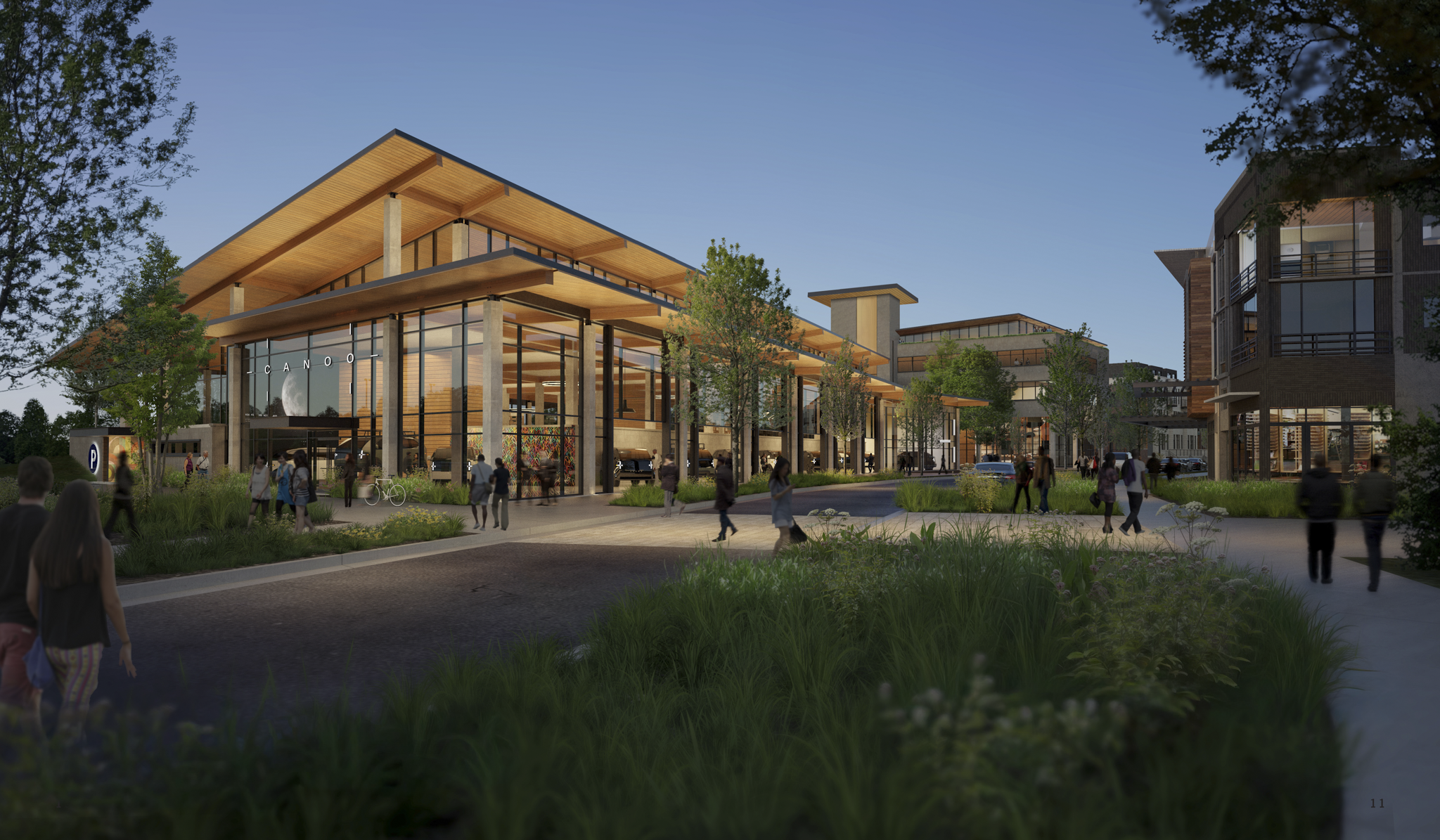
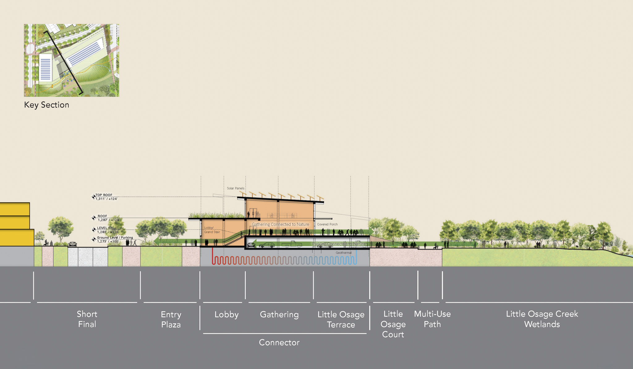
The plan organizes 26 acres around two converging forces: the natural logic of Little Osage Creek and the geometric logic of the airport's final approach. Short Final — the district's primary street — follows the flight path inward, arriving at the office campus where building, berm, creek, and landscape meet. Live/work housing, retail, food and beverage, and civic open space line the corridor, making the district a genuine gateway to Bentonville's Pattern District rather than an isolated corporate campus.
High-tech office campus integrating industrial gallery, flexible workspace, and landscape berm
Live/work neighborhood of 275 residential units with ground-floor retail and parklets
Little Osage Way multi-use path and boardwalk connecting creek to regional trail network
Detrola Motel adaptive reuse with event courtyard and community activation
Short Final arrival corridor organizing movement from SW 14th Street to campus core
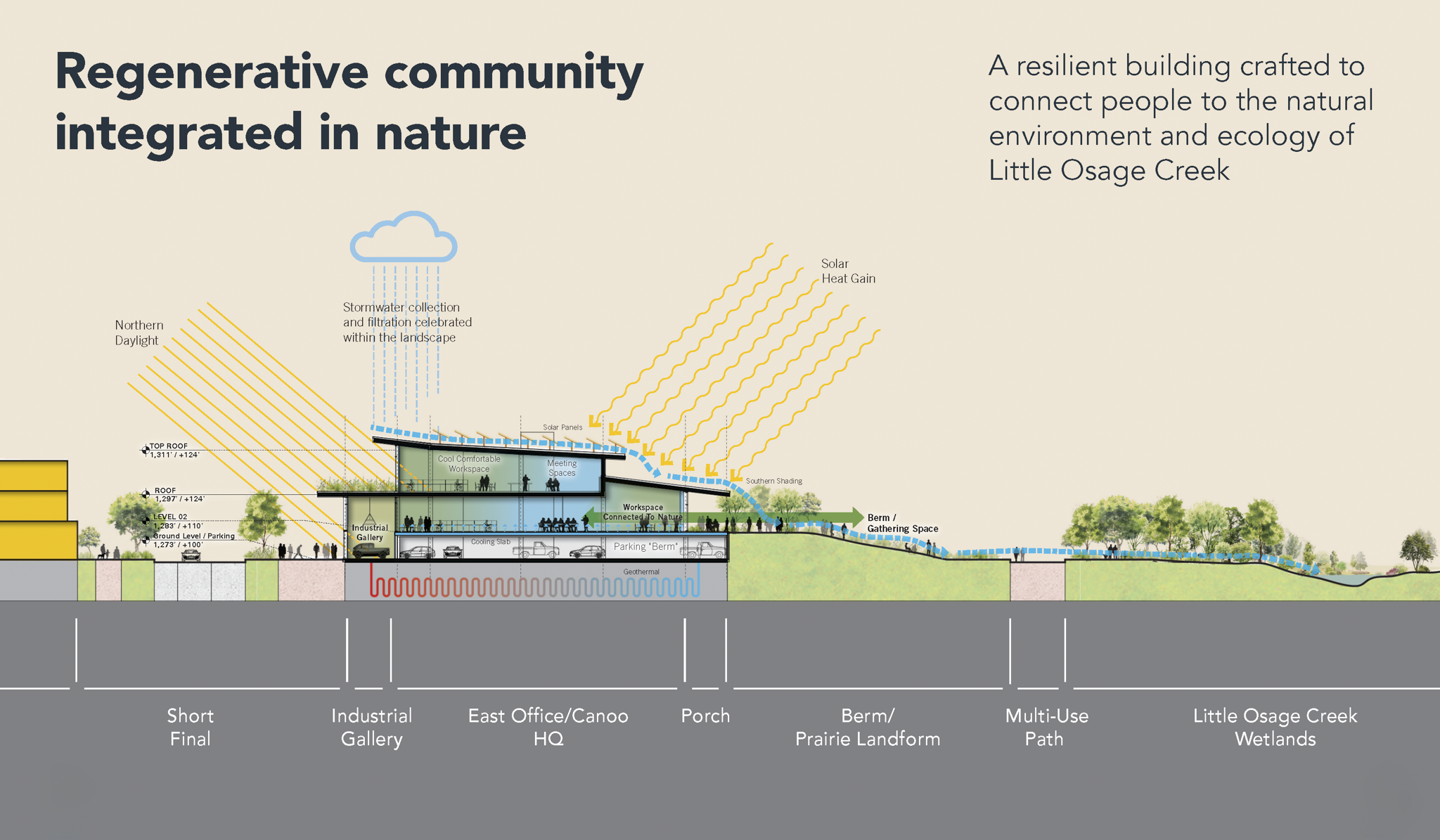
Regenerative building systems — geothermal, solar, stormwater — integrated into landscape
-
Client: Green Circle Projects
Role: Urban Design and Master Planning while at Tryba Architects
Deliverables:
District Master Plan
Site Plan Architectural Vision
Program and Yield Analysis
Phasing Strategy